


Chemin_de_Stevenson_#J5_Le_Pont-de-Montvert_-_Florac

BureauChris
User
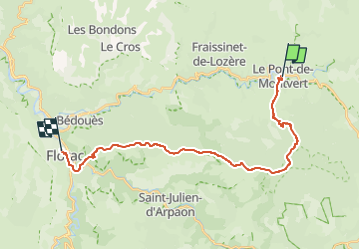

Length
23 km

Max alt
1421 m

Uphill gradient
789 m
Km-Effort
35 km

Min alt
546 m

Downhill gradient
1116 m
Boucle
No
Creation date :
2022-05-26 14:44:45.766
Updated on :
2022-05-26 14:46:18.756
7h56
Difficulty : Very difficult

FREE GPS app for hiking
 SityTrail
IGN / Geographical institutes
SityTrail Plus
The world is yours!
About
Trail Walking of 23 km to be discovered at Occitania, Lozère, Pont de Montvert - Sud Mont Lozère. This trail is proposed by BureauChris.
Positioning
Country:
France
Region :
Occitania
Department/Province :
Lozère
Municipality :
Pont de Montvert - Sud Mont Lozère
Location:
Unknown
Start:(Dec)
Start:(UTM)
559260 ; 4912435 (31T) N.
Comments